
Naturalisation of Johnstons Creek
Diane Hutchinson forwarded a report from Council about storage arrangements for Sydney Water in Bicentennial Park. Here is the relevant section from the Sydney Water website. This is all the information available this stage: ‘Johnstons Creek is a concrete-lined channel in Annandale, between Federal and Jubilee Parks. The naturalisation project will improve the environment and social amenity of the creek. We’re currently in the design stage of this project and construction is proposed for around 2019.’
Harold Park
Work has begun on the shade structures for the play and picnic areas, and the fences have been moved back at both the northern and southern ends, allowing access to the steps up to Boyce St.
Affordable Housing
Information is available via the Sydney Have Your Say website. The proposal is to amend Council controls to allow Council to require monetary contributions from multi-unit development up to the level approved by the Commission for Greater Sydney.
City West Housing is charged with providing affordable housing in the City. Consult their website if you want to know more about how they operate. Work on the Harold Park site is due to commence this year and be completed next year, as already announced in this column. Individuals can comment on the proposed changes, but the Society will also make a submission.
Better Planning Network Seminar
The long-awaited seminar on the new NSW Planning Act is to be held in the new Harold Park Community Room at 1pm on Saturday, 11 August. I will be attending of course, but if others wish to do so they should contact BPN.
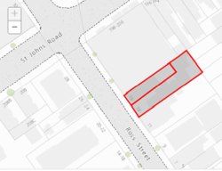
13-15 Ross St
There is an application to demolish the existing dwellings and construct a boarding house with twenty rooms over four storeys.
Ross St has had a difficult history, and the Society has often protested against inappropriate development. Our greatest success was the campaign to save Fine’s Corner at the intersection of St Johns Rd and Ross St, where we organised a street march an interview with the ABC (see Bulletin No 1 of 2013, p.4). More recent protests have been less successful.
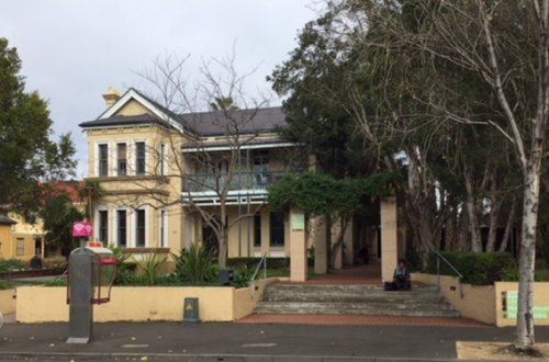
Glebe Point Rd Main Street Study (Stage 2)
In November 1991, the Glebe Society and Glebe Chamber of Commerce jointly published a study of the entire length of Glebe Point Rd (there are copies in Glebe Library). This study is arguably the most important achievement of the Glebe Point Road Project, begun in 1989.
The Study, which includes many buildings outside the scope of Kate and Bernard Smith’s Architectural Character of Glebe, consists mainly of photos of all buildings in Glebe’s principal street accompanied by historical information, analysis, recommendations and significance. While some contiguous buildings are grouped together, essentially there is one page per building, and a copy of the appropriate page was sent to the owner of each building.
The Study had a profound impact on Glebe Point Rd.


There are no comments yet. Please leave yours.